The 2017 Atlantic hurricane season was the costliest and most intense on record. The new reality of more destructive tropical storms due to climate change means that America's coasts—especially those in areas prone to hurricanes—are more vulnerable to erosion now than ever. This poses a critical challenge for many communities, as they must not only retrofit and build newer, more resilient coastal structures but also continuously repair damage to old ones.
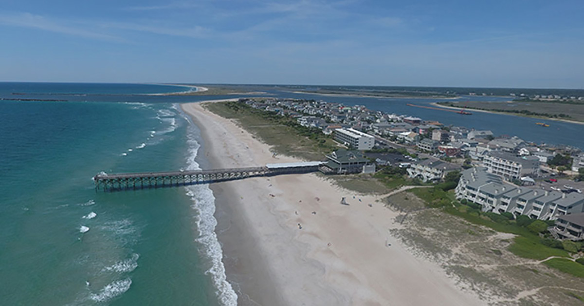
One part of the mid-Atlantic that experiences particularly severe beach erosion is the outer banks of North Carolina. These shores must be frequently monitored in order to keep track of the effects of storms, hurricanes, and other natural events that gradually take their toll on the coastline. However, this task can be expensive, time-consuming, and logistically challenging. The agency responsible for this is the US Army Corps of Engineers (USACE), which conducts regularly scheduled beach renourishment projects along the shores of both North Carolina and South Carolina.
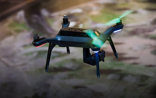
The challenge USACE faced was to survey the damage to the beaches in order to make the necessary and targeted fixes to mitigate the effects of weather. The method that is typically used in these types of land surveys is to use terrestrial lidar, where the surveyor must manually place stationary lidar scanners in designated areas to take readings. In an area that can sometimes encompass miles of shoreline that includes cliffs, rocks, and hard-to-access locations, this can be not only time-consuming but also dangerous to the surveyor taking the readings. The solution to this was a combination of drones and location intelligence technology, which freed surveyors from a landlocked viewpoint.
 Small, Agile, Accurate
The City of Wrightsville Beach, North Carolina, contacted location intelligence technology provider Esri and McKim & Creed, a civil engineering and surveying firm, to launch a pilot program to see if drones could be used to help city staff more efficiently assess coastline damage after severe storms and hurricanes. The USACE needs to conduct beach renourishment projects on a regular basis, so one of this project's specific aims was to evaluate whether low-cost commercial drones could produce accurate, high-resolution 2D and 3D geospatial data for beach renourishment surveys and volumetric measurements. Another goal was to enable USACE to understand the environmental impacts of using these drones. The teams from Esri and McKim & Creed were able to find and document all of these details by using Esri's application Drone2Map for ArcGIS, which allows users to quickly turn still photographic imagery taken from drones into 2D and 3D imagery products that can then be easily analyzed.
McKim & Creed placed 14 survey targets on the beach and randomly collected 22 blind checkpoints. After performing Dense Image Matching (DIM), the point clouds were compared to the blind checkpoints to verify accuracy. Speed was also a critical aspect of the project, as 75 acres of topographic data needed to be captured at a 1.05-inch resolution in less than 60 minutes. The comparison points were what the teams were looking at as they focused on how using drones compared to both conventional survey methods and terrestrial lidar.
Time Flies
The teams at Wrightsville Beach created a five-mile beach profile that would help them analyze the drones' results compared to those from other, more traditional survey methods. The USACE performed the terrestrial lidar tests in almost the exact same conditions, incorporating the survey targets placed for the drone flight earlier that same day. When comparing datasets, information produced by the drone was nearly as accurate as the information produced by the terrestrial lidar. The two surfaces matched up in every important way except that the terrestrial lidar data went further out—this was due in part to the receding tide at the time when the lidar data was collected.
Compared to conventional surveying methods, using drones proved to be 30 percent less expensive and captured greater detail in less time. When compared to terrestrial lidar surveying, drone data collection was 15 percent less expensive and proved to have a faster collection and processing time. The teams at Wrightsville Beach showed that drone data gathering does not significantly impact the accuracy of the data that's being collected and clearly represents significant savings in both time and cost. In recognition of the project and these results, McKim & Creed was awarded the Grand Conceptor Award from American Council of Engineering Companies of North Carolina.
 Adapting to the New Normal
Certain measures to curb the causes of climate change have been initiated in earnest, and those measures can certainly mitigate its effects to a degree. But we must come to terms with the fact that more intense and extreme weather patterns have become the new normal for many parts of the world. Specifically, the coasts that are vulnerable to perennial hurricanes will need to adapt to a globally changing climate. Communities that sit on the threshold between dry land and rising sea levels must update fundamental aspects of planning, like infrastructure, building codes, and emergency response. But in order to know how to adapt to a changing world, communities must first know how that world is changing and to what degree.
Location intelligence offers a precise view of what is happening to the world around us as well as when it is happening. The unique tool that McKim & Creed put to the test at Wrightsville Beach showed that budget and time are not impediments for people who need to understand how their geography is being affected by climate change. But what makes the difference isn't just taking a drone up in the air and snapping a few pictures. Drone2Map takes this easily sourced imagery and places it into a context that hurricane-prone communities can use. Imagery products capable of providing insightful information through analytics—such as showing, down to precise measurements, how much erosion has occurred over how long and where—allow agencies to plan and rebuild with equal precision. In this new normal of extreme weather, the key is no longer to rebuild stronger—it's to rebuild smarter.
By Kurt Schwoppe, Business Development Manager for Imagery, Esri