
Technological Innovation for Enhanced Resilience
The company recently launched a new public tide app that tracks live tide measurements from hundreds of Hohonu and NOAA stations. The app TideCast also makes tidal predictions for thousands of locations across the US and Pacific, all viewable from your iPhone. The detailed graphs let you quickly see recent or upcoming high and low tides, with live tide data that measures actual observed water levels compared to the predictions. You can also see weather conditions like wind, precipitation, and lunar phases and how they affect the tides. The app is being widely used by recreationists, including surfers, boaters, and fishing communities. You can look up tidal predictions months in advance and share data from specific stations with family and friends.
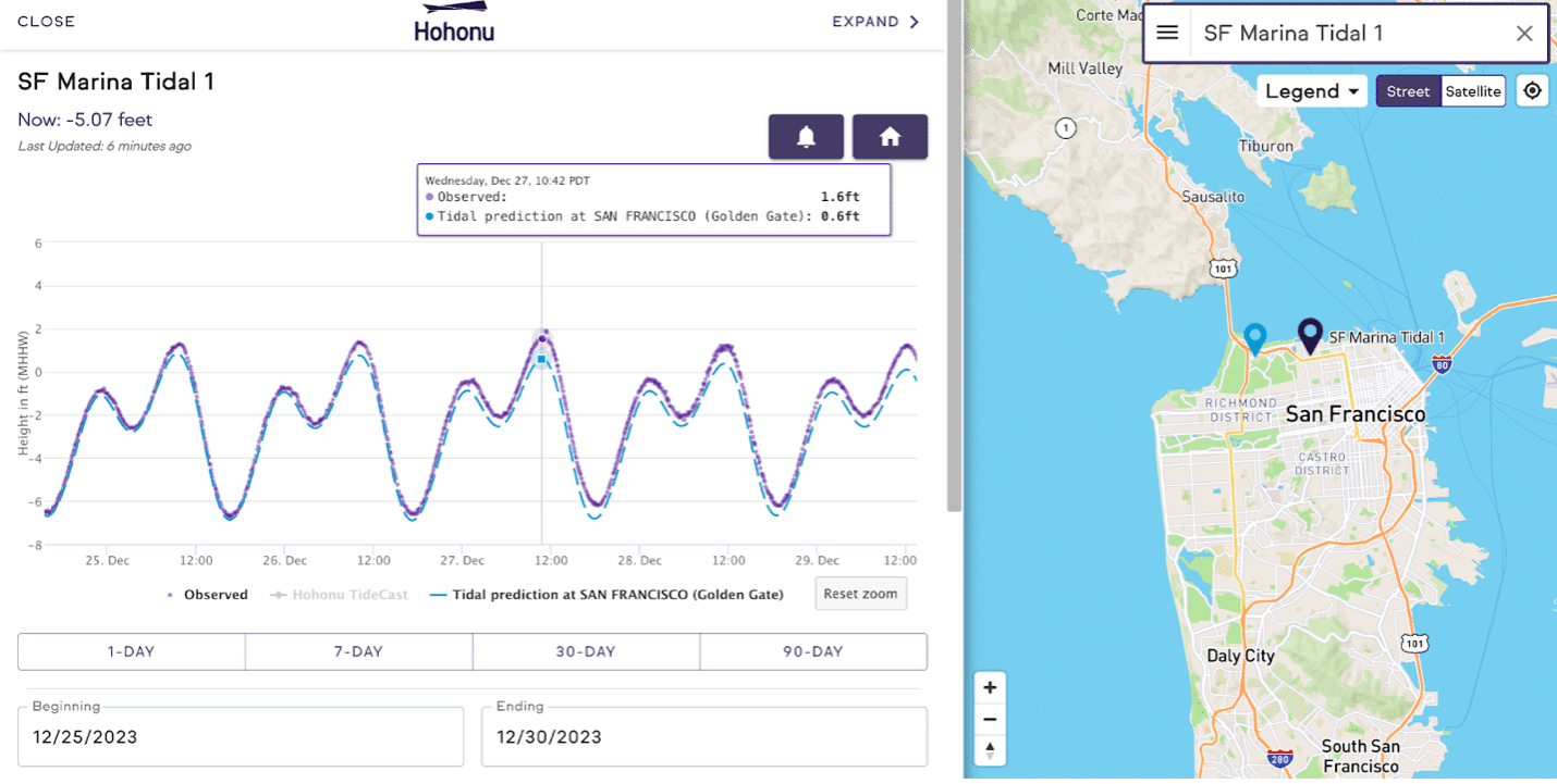
A tidal sensor in San Francisco Bay captures a combined King Tide/ storm surge event, revealing significantly higher water levels than predicted and underscoring the escalating impacts of climate change on tidal patterns and coastal communities. (Image credit: Hohonu)
The move to bring data to the public and communities marks a significant step towards better flood preparedness and resilience. As coastal communities continue to face the challenges of rising sea levels and more frequent storms, the real-time data provided by these sensors will be invaluable in informing strategies and protecting vulnerable areas.
Annapolis: A Model for Coastal Resilience
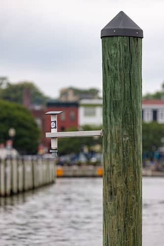
The City of Annapolis, in collaboration with the University of Maryland and Hohonu, has deployed a state-of-the-art water level monitoring system. This innovative project aims to enhance data collection and improve flood resilience strategies in the Chesapeake Bay area, with a particular focus on Annapolis’ City Dock.
Anne Arundel County, which includes Annapolis, has approximately 533 miles of vulnerable coastline and is at the forefront of this initiative. Matthew Fleming, Executive Director for the Resilience Authority of Annapolis and Anne Arundel County underscored the city’s commitment to proactive flood management. “Annapolis is ground zero for coastal flooding,” said Fleming. “Through this initiative, the City will not only receive real-time, hyper-local data streams on water levels but will also have the opportunity to work alongside Dr. Canty and University experts on the development of decision support tools critical for emergency response and resilience planning.”
Researchers from the University of Maryland Climate Resilience Network and local government leaders demonstrate the Maryland HydroNet, a new university water-level monitoring project designed to prepare coastal communities like Annapolis for the increasing impacts of flooding due to climate change. (Image credit: John T. Consoli, University of Maryland)
The practical benefits of this project are already evident. Burr Vogel, Director of Public Works for the City of Annapolis, recounted a recent incident that highlighted the need for accurate flood data. “During rush hour Wednesday, April 24th, the City experienced a high tide that was 5 inches higher than had been predicted the day before,” said Vogel. “The unexpected flooding closed traffic on the Spa Creek bridge, creating major traffic problems throughout the city. Our flood barriers would have prevented this closure if they had been in place, but we didn’t have accurate data to help us help our residents. This project is arriving at just the right time.”
Dr. Timothy Canty, associate professor in the Department of Atmospheric Science and director of the Maryland Marine Estuarine Environmental Sciences graduate program at the University of Maryland, emphasized the importance of this project. “The health of the Chesapeake Bay is vital to the health of the Maryland economy, but our coastal communities face increasing flood risks as sea levels rise,” said Dr. Canty. “This project is the first step in providing the state with a larger network of water level monitors to help better allocate resources, prioritizing assistance for communities facing the most imminent risks.”
The deployment of sensors around the Chesapeake Bay will provide vital information not only for Annapolis City Dock but also for other coastal communities. This data will be instrumental in planning future flood protection projects and improving emergency response strategies.
As the project progresses, the data collected will not only benefit Annapolis but will also contribute to a broader understanding of flood dynamics in the Chesapeake Bay region. This knowledge will be crucial in developing effective flood protection measures and ensuring the long-term sustainability of Maryland’s coastal areas.
Real-World Impacts and Future Planning
The partnership between the City of Annapolis, the University of Maryland, and Hohonu represents a forward-thinking approach to addressing the complex issue of coastal flooding. By leveraging advanced technology and real-time data, this initiative aims to create a robust framework for flood resilience that can serve as a model for other coastal communities.
Hohonu’s Founder and CEO, Dr. Brian Glazer, highlighted the significance of real-time data in addressing the growing challenges posed by frequent and intense flooding events. “This is one of many projects that Hohonu is servicing on the east coast of the United States,” said Dr. Glazer. “We are working to provide solutions for a growing demand for real-time data in flood monitoring. Just this year, our sensors have monitored three named storms and over 50 distinct flood events across our 80 east coast locations.”
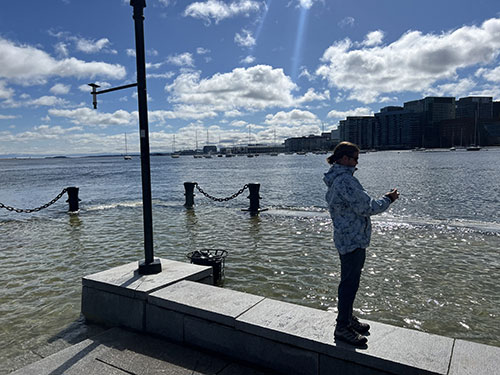
Hohonu CEO Dr. Brian Glazer with tide gauge in Boston during a flooding event. (Image credit: Hohonu)
The integration of these sensors into a broader network will enhance data resolution and understanding of flood frequency and impact across the state and the US. Annapolis is setting a national example by adopting a proactive resiliency strategy in response to the imminent threat of rising sea levels. Hohonu has recently launched other community projects with Homeowners Associations and nearby fire departments in Cape Cod, Massachusetts, the floodplain management office for Pierce County in Tacoma, Washington, and researchers at Texas A&M University-Corpus Christi to develop new methods to measure wave heights in order to act as an input to a coastal inundation model for the location for future storm events.
Dr. Brian Glazer is an Associate Professor of Oceanography at the University of Hawaii and Co-Founder and CEO of Hohonu.Inc.
