")
The award will fund the creation of an academic track in the field of geodesy, and the modernization of a key US spatial database.
UC San Diego’s Scripps Institution of Oceanography has been selected by the National Oceanic and Atmospheric Administration (NOAA) to receive a five-year $6.5 million Geospatial Modeling Grant.
The grant will enable the creation of an academic track within the Scripps Geophysics graduate program in geodesy, a field that studies Earth's geometric shape and its deformations, orientation in space, and gravity field. In addition to expanding Scripps’ geodesy curriculum, the grant will support Scripps researchers’ efforts to update the National Spatial Reference System (NSRS), a consistent coordinate system that defines latitude, longitude, height, scale, gravity, and orientation in the United States. Modernizing the NSRS will improve its accuracy for important applications such as sea level rise planning via improved floodplain maps, resilient infrastructure, and evacuation routes for coastal hazards.
In the past, geodesists used Earth-based surveying tools to measure the distance between points and then assigned coordinates to points all over the planet. Today, geodesists primarily use satellites like the US fleet of 31 Global Positioning System (GPS) satellites to assign those coordinates and to measure points on the Earth’s surface.
At its most basic level geodesy can be used to create accurate maps of features such as the contours of a shoreline or a geographic boundary. But while the average smartphone’s GPS is only accurate to about five meters (16 feet), geodesists can use GPS to obtain geospatial measurements that are accurate down to the millimeter (0.04 inches). Such fine-scale measurements of Earth’s surface through time can be used to infer geologic activity such as the movement of tectonic plates, the underlying physics of an earthquake, or even an impending volcanic eruption.
As a discipline, this means geodesy overlaps with many other fields and has an array of applications from mitigating natural hazards to national security. Despite these many important uses, there is a shortage of newly trained geodesists entering the field in the US, according to Yehuda Bock, a Scripps researcher trained in geodesy who now applies his skills to geophysics.
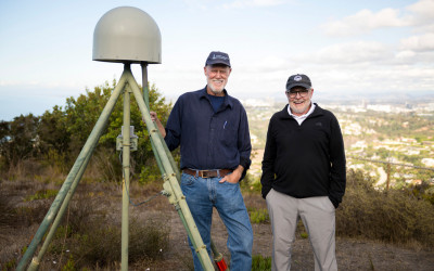 Geophysicists Yehuda Bock (left) and David Sandwell (right) are co-principal investigators on the program. (Image credit: Erik Jepsen, UC San Diego)
“China and Europe have many geodesy programs, but for some reason the US has lagged behind and now there are not many places that teach it and there are not many teachers,” said Bock, who also directs the California Spatial Reference Center. “This grant is going to allow us to begin to remedy that by making Scripps a marquee destination for geodesy training.”
The NOAA grant will support the creation of a geodesy track within the Scripps Geophysics program, including up to three new graduate-level courses and funding for five graduate students over the course of five years. Bock and others are also exploring the possibility of founding a geodesy center at Scripps.
The second half of the proposal funded by the NOAA grant will update the NSRS database. The NSRS was created by NOAA’s National Geodetic Survey (NGS) and features a collection of more than 1.5 million points across the US Avid hikers may have even seen the metal discs, usually brass, bronze, or aluminum, that NGS uses as survey markers.
Specifically, Bock said he and other Scripps researchers will be adding in data gleaned from satellite measurements of deformations of Earth’s crust for the US Accounting for these movements in Earth’s crust in areas where it is particularly active will yield a more accurate system, providing an up to date spatial frame of reference for people such as scientists or civil engineers who require precise positioning.
“In the next five years we hope to fully develop our geodesy curriculum, to move towards a center of geodesy at Scripps that will be visible to the outside world, and hopefully attract more students to this important and exciting field,” said Bock. “If we can train the next generation of geodesists while contributing to the modernization of the NSRS we will have been extremely successful.”
Bock and his Institute of Geophysics and Planetary Physics collaborators Adrian Borsa, Yuri Fialko, Jamin Greenbaum, Jennifer Haase, Robert Mellors, David Sandwell, and Mark Zumberge, as well as Center for Climate Change Impacts and Adaptation collaborators Mark Merrifield and Matthew Mazloff will all work together on NOAA's Geospatial Modeling Grant.