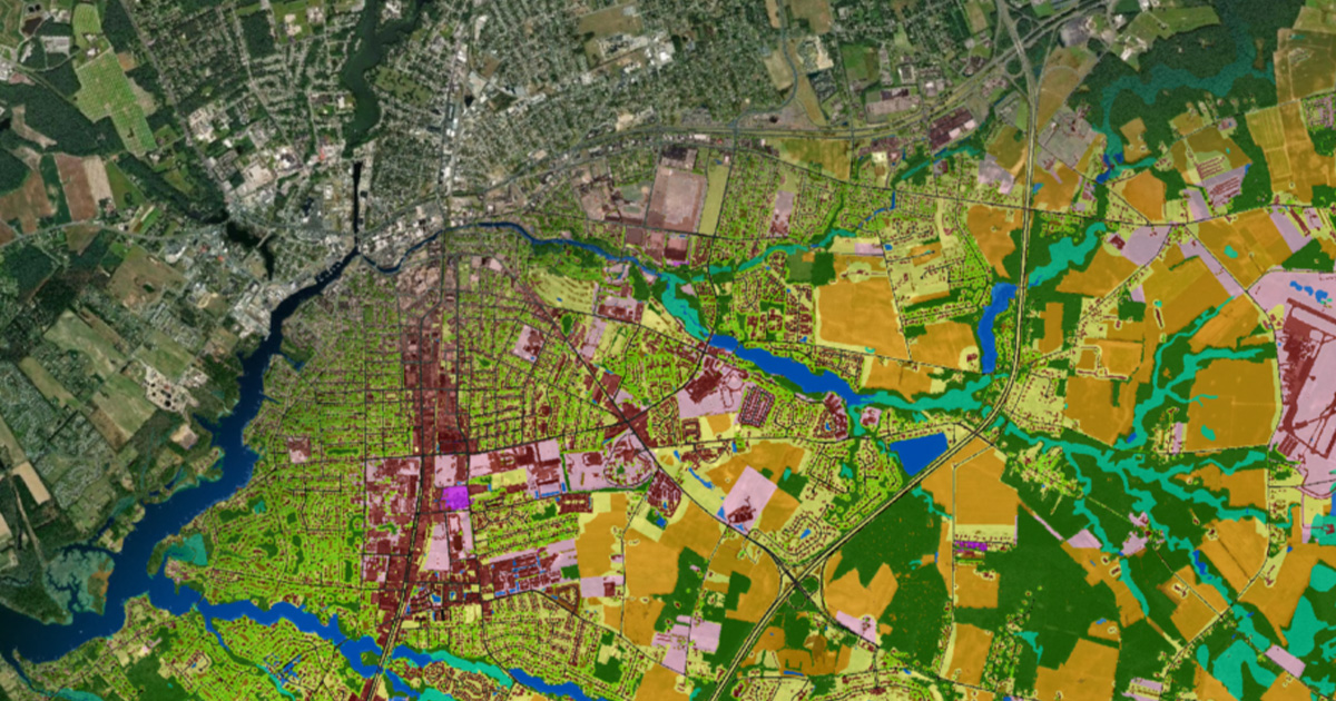
Recent analysis of land use and land cover data from the Chesapeake Bay Program’s Very-High Resolution Land Use/Land Cover and Change Data show 1,927,940 acres (3,012.4 square miles) throughout the watershed are covered by impervious surfaces.
This represents 4.75% of the entire land area of the Bay watershed (an area of approximately 40,546,643 acres, or 63,354 square miles). Impervious surfaces are considered to be any area that blocks the filtration of water.
These data were captured in 2017/2018 as part of the Very-High Resolution Land Use/Land Cover and Change Data project. This innovative technology also included an update to the previous high-resolution dataset from 2013/2014 and included a new data product that describes the changes in land use and land cover throughout the Chesapeake Bay watershed from 2013/2014 and 2017/2018.
When compared to previous data mapped in 2013/2014, impervious cover increased by 50,651 acres (79.1 square miles), which is an absolute increase of 0.12% as a percentage of land area. The fastest developing regions throughout the Chesapeake Bay watershed are the suburban areas surrounding Baltimore, Maryland, Harrisburg, Pennsylvania, Richmond, Virginia and Washington, D.C.
The data finds that structures (e.g., buildings) contributed to 31.6% of the net increase in impervious surfaces, while roads only contributed to 4.2%. However, the category of “other impervious surfaces”, defined as human-constructed objects such as driveways, parking lots, runways, rail lines, etc. saw the highest increase at 64.3%. This category also includes those areas currently in interim stages of development, such as acres cleared for construction.
The Very-High Resolution Land Use/Land Cover and Change Data was also used to help understand the loss of tree canopy across the Chesapeake Bay region. While 8,307 acres of trees have been planted across the watershed between 2013/2014 and 2017/2018, over 25,000 acres of tree canopy has been lost in community areas (defined as municipalities, cities, towns, villages, and boroughs by the US Census).
To track real-time progress that each jurisdiction is making in planting trees to increase their canopy, the Chesapeake Bay Program uses annual progress data for three best management practices (BMPs) that are reported for the Chesapeake Bay Total Maximum Daily Load. The three BMPs are Urban Tree Planting, Urban Forest Planting and Urban Forest Buffers. As the BMP reporting only captures tree canopy gains, the Very High-Resolution Land Use/Land Cover and Change Data helps to assess losses.
Maryland, Pennsylvania, and Virginia saw the highest number of trees planted in community areas during the period of 2013/2014-2017/2018, at 6,501, 915 and 445 acres, respectively. During the same time period, 359 acres were planted in the District of Columbia, 14 acres in Delaware, 40 acres in New York and 33 acres in West Virginia. It is critical to remember that Delaware, New York, and West Virginia only contain a small portion of the Chesapeake Bay watershed when compared to the other four jurisdictions.
Maryland reported the greatest cumulative community tree planting, with almost 86% of the total reported acres across the watershed coming from the state. However, it also showed the greatest net loss at 4,537 acres.
Despite the overall declining trend of tree canopy across the watershed, both the District of Columbia and New York reported net gains during 2013/2014-2017/18, at 78 and 21 acres, respectively. In particular, New York exceeded its annual goal of planting five acres per year in its portion of the Chesapeake Bay watershed.
The Chesapeake Bay Program’s Forestry Workgroup, in collaboration with the US Forest Service and the Chesapeake Conservancy, used the Very-High Resolution Land Use/Land Cover Data and Change Tool to develop a series of fact sheets for every county in the watershed. The Tree Cover Status and Change fact sheets includes the breakdown of land use and land cover in each county, including the net gain or loss. It also estimates the value of benefits provided by the trees in the county.


