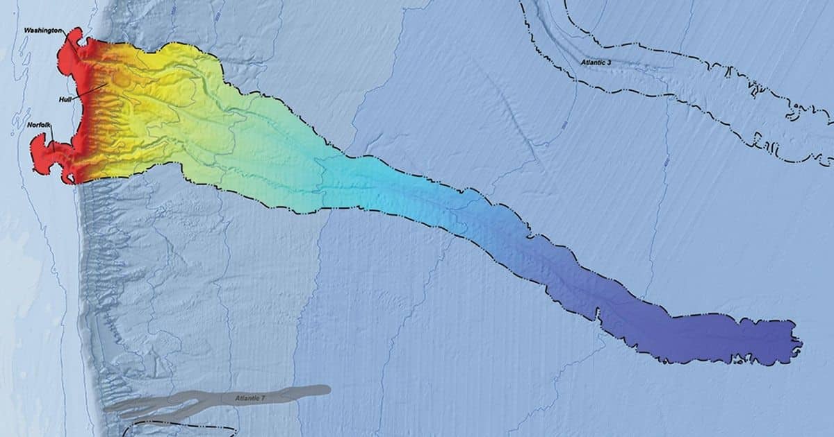
CSA Ocean Sciences Inc. (CSA), a marine environmental consulting and survey company, today announced details of an exclusive new project in partnership with The Department of the Interior, Bureau of Ocean Energy Management (BOEM) to map and characterize medium-to-large submarine canyons in the US Exclusive Economic Zone (EEZ). This comprehensive open-access depository of maps and seafloor data will prove instrumental to the development of national and regional Environmental Impact Statements (EISs), Environmental Assessments (EAs), ecological investigations, offshore leasing decisions, and President Biden’s “America the Beautiful” initiative.
The project serves as a follow-up to a similar collaboration between CSA and BOEM in 2019, which culminated in the publication of the Large Submarine Canyons of the United States Outer Continental Shelf Atlas (OCS Atlas), issued in November of the same year. The 2019 study initially identified approximately 700 Outer Continental Shelf (OCS) submarine canyons over 10 km long, 130 of which were categorized as “large” canyons (at least 75 km long, 1 km wide, and incised by at least 100 m). The project Team then narrowed the focus to 71 of these large canyons—based on size, location, and availability of information—for detailed mapping and literature review.
“The 2019 OCS Atlas prioritized a certain group of the larger canyons within the OCS, and our task now is to produce additional definitive maps, complete with bathymetric contours, of many of the important medium-to-large submarine canyons that remain, including those beyond the OCS but within the 200-nm reaches of the US EEZ,” explained CSA project lead Steve Viada.
As this decade of ocean exploration progresses, there is a growing need for an open-access online resource to help advance a series of multistakeholder ocean mapping initiatives, including the National Ocean Mapping, Exploration, and Characterization (NOMEC) and the National Strategy for Mapping, Exploring, and Characterizing the U.S. EEZ (Ocean Policy Committee, 2020). To this end, CSA’s deliverables will extend to the creation of an online geodatabase inventory, to be housed by BOEM, which will include a fully digital atlas with metadata and all supplementary information available as it relates to all medium-to-large EEZ and OCS submarine canyons.
“We are delighted to be collaborating with BOEM again to bring further clarity and understanding to the little studied world of submarine canyons,” said CSA CEO Kevin Peterson. “An undertaking of this magnitude not only relies on the right subject matter experts for the job—select marine scientists with a working knowledge of the geophysics and biological ecosystems that define these seafloor canyons—but also the Geographic Information System (GIS) software and tools to present this information in the most intuitive and insightful way possible—CSA’s continual investment in both makes us perfectly equipped to deliver.”
The final delivery date for the completed scope of work is November 2022.
About CSA
CSA Ocean Sciences Inc. brings over five decades of experience in marine environmental assessments in the U.S. and internationally, with offices in the United States, the Eastern Mediterranean, Qatar, Trinidad, Brazil, and Australia. CSA’s expertise in coastal, marine, and deep ocean surveys is built on the integration of science, operations, and an understanding of environmental data collection, management, and analysis within geospatial domains. For more information on CSA’s range of marine environmental consulting services, please click here.

