Offshore wind power has become an economically viable means to generate renewable energy. This rapidly evolving globally industry is also becoming a core energy option in many coastal American states.
Offshore wind farm development cycles are, however, heavily reliant on in-depth meteorology and physical oceanographic information. Metocean information generally entails profiles of wind, wave, current, and water level conditions pertinent to the planning, design and construction of offshore projects. Highly reliable met-ocean data, analyses and design basis figures are therefore essential for the offshore wind industry. In fact, a common challenge for offshore wind developers is to avoid delays associated with the time it takes to find, analyze, and report on met-ocean data.
DHI is international Danish research and consultancy organization, with offices in the United States, that maintains more than 50 years of expertise in providing numerical modelling-based solutions for ‘Water Environments’. It is with this pedigree that DHI recently unveiled a new MetOcean Data Portal that delivers validated met-ocean data and analytics within minutes. The MetOcean Data Portal allows users to download and validate nearly 40 years of met-ocean data, including wind, wave, water level and current data from around the globe. The continuously evolving portal is based on extensive wave and hydrodynamic modelling using MIKE Powered by DHI software. The speed and accuracy of this advanced system will greatly benefit users who need reliable data for design and project development purposes.
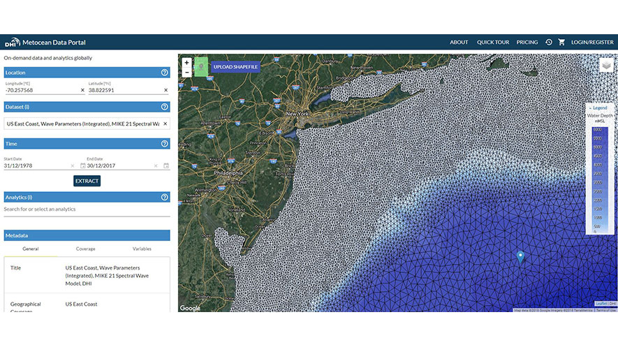
Portal users can extract data for the desired area of interest by placing the marker on the map and selecting a dataset. In addition to accessing data from high-resolution local, regional, and global models, user can also benefit from on-demand calculations of commonly requested analytics. Before purchasing the data, users are able to request site-specific validation of wind and wave data against satellite altimeter measurements.
The strong demand for instant access to accurate met-ocean data along the east coast in the United States led DHI to specifically develop a high resolution regional hydrodynamic and wave model for the U.S. East Coast, which is included in the MetOcean portal output. The modeling analyses covers a period from 1979 up to 2017 in an area stretching from north Florida up to Nova Scotia. It also reaches resolutions of 3km near the coast. Validation with local measurements and satellite data have proven a high accuracy of the model results. It is anticipated that this data will be extremely valuable for offshore wind developers in all stages of their project cycle.
“The MetOcean Data Portal is a leap forward when it comes to the availability and accessibility of decades of high-quality Met-ocean data. It has already greatly improved our responsiveness within planning and FEED design of support structures in the offshore wind sector,” Anders Sørrig Mouritzen, Director and Technical Lead, C2Wind ApS, said.
The MetOcean Data Portal can be accessed by clicking here*.
*Best viewed using Google Chrome