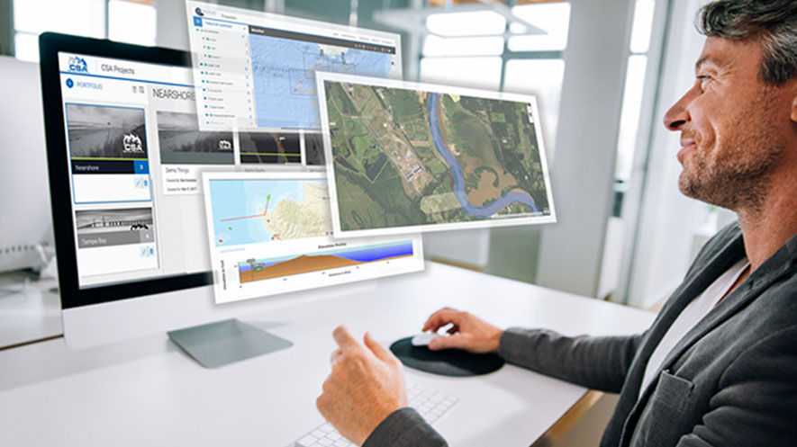
CSA Ocean Sciences Inc. (CSA), a specialist in the collection, analysis, and management of environmental data, announced the implementation of the newly released EDGSonline 2.0, the next generation of its web-based mapping and data visualization platform developed by sister company, GeoFac Systems Inc.
Access to data and documentation is crucial for sharing information about a project, region, or incident. CSA’s Environmental Data and Geospatial Services (EDGS) provides comprehensive solutions to enhance the accessibility and meaning of data, whether in geospatial, tabular, document, video, or image format. CSA has worked closely with GeoFac to develop the custom cloud-based EDGSonline platform, which enables registered users to visualize, access, query, and download data using only a web browser.
“EDGSonline is used by CSA’s subject matter experts, partners, and clients to communicate, collaborate, and centralize deliverables,” said Dr. Jodi Harney, manager of CSA’s EDGS team. “Listening to our clients and users, we have worked with GeoFac to upgrade the application to include new tools and a more progressive interface, completely redesigned with the user experience in mind.”
Enhancements in EDGSonline 2.0 include greater security, more user tools, advanced querying capabilities, improved document management, and integrated videospatial capabilities. Key features now include:
- Portfolios and Folios – This innovative structure allows the organization of map services and data layers into hierarchical, user-defined assemblies of information enabling users to quickly access, revise, and analyze frequently needed material and better communicate and share compelling stories.
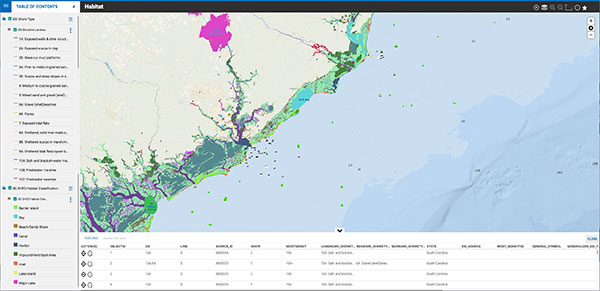
- Advanced Search – Built to be intuitive, this tool allows users to interrogate the data behind the view, from employing simple filters to complex, multi-step queries. Results are displayed in an integrated, exportable data table as well as highlighted in the accompanying map view.
- Videospatial Tools – Customized for managing, viewing, assessing, and delivering video in a geospatial context.
- Document Management – Users with publishing capabilities can associate any type of document with a spatial feature (point, line, or polygon), either uploading the document or linking it to other web-based document management software. This tool ensures that the most up-to-date documentation is secure and accessible. Users can search for documents interactively in the map view using keywords or by browsing a library.
- Data Security – Enhanced security measures include a unique Uniform Resource Locator (URL) web address for every portal industry standard in-depth security controls, EDGSonline 2.0 ensures data confidentiality, integrity, and availability.
 EDGSonline 2.0 is delivered to clients as a cloud-based Software as a Service (SaaS) solution licensed on an annual subscription basis or in association with a project. For more information on EDGS, click here.