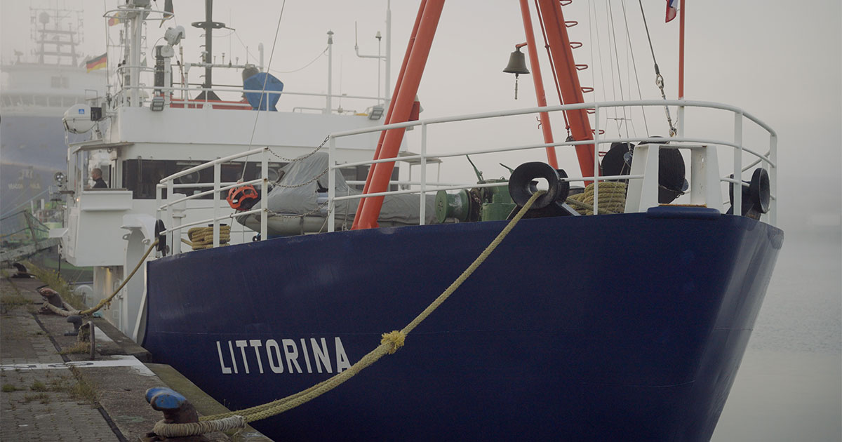
The data collected will help to better understand future risks and make predictions. Tomorrow, the GEOMAR Helmholtz Centre for Ocean Research Kiel is taking over the last part of this spontaneous measurement campaign in the German Bight with the research cutter LITTORINA under the leadership of Dr Björn Raupers.
As part of the MOSES (Modular Observation Solutions for Earth Systems) program, researchers from various Helmholtz Centres have been studying the state of the Elbe from its source to its mouth for several years. Starting this year, the new ElbeXtreme project will focus on extreme events as part of the mareXtreme research mission of the German Marine Research Alliance (DAM).
Now there was the rare opportunity to carry out the investigations during a flood event. Thus, an ad-hoc MOSES campaign was launched during the Christmas holidays in 2023, tracking and sampling the flood wave from the Czech border to the North Sea. The research question is: How do extreme events such as a flood alter the composition of the body of water? The investigations comprised measurements of conductivity and water temperature using sensor probes. Simultaneously, water samples were collected for laboratory analysis of biogeochemical parameters such as carbon compounds, nutrients, microcontaminants, metals, and pigments.
Always in the right place at the right time: from Bad Schandau to Cuxhaven
Since the onset of the flood at the end of December, scientists led by Dr. Norbert Kamjunke from the Helmholtz Centre for Environmental Research (UFZ) tracked the crest of the flood wave for eight days, from Bad Schandau at the German-Czech border to Lauenburg near Hamburg. Access to the river was often challenging due to the flooding of the surrounding areas, leading to the collection of most samples from bridges along the river course.
From the Geesthacht weir, colleagues from the Helmholtz Centre HEREON took over the monitoring of the flood wave in the tidal Elbe and its entry into the German Bight. Despite the short notice, their investigations were actively supported by the Hamburg Port Authority (HPA) and the Glückstadt-Wischhafen ferry company (FRS), which made the targeted sampling along the tidal river possible in the first place, says Dr. Götz Flöser, a physicist at HEREON.
On the trail of freshwater: How is the wave distributed in the North Sea?
Following the arrival of the flood wave near Cuxhaven at the mouth of the Elbe River in mid-January, scientists from the Alfred Wegener Institute, Helmholtz Centre for Polar and Marine Research (AWI) continued the observations. They spent over a week in the Elbe estuary with the research vessel MYA II, sampling the same substances as in the Elbe.
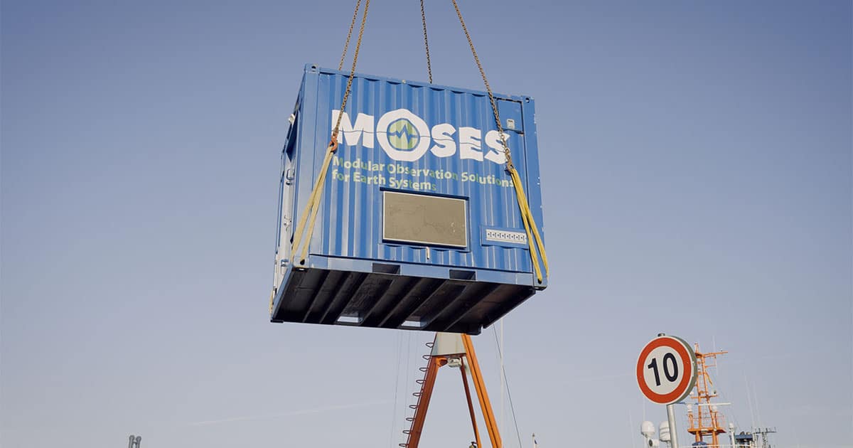
Tomorrow, the GEOMAR Helmholtz Centre for Ocean Research in Kiel is taking over the last section: sampling in the German Bight. On Helgoland, the LITTORINA will take over the fully equipped MOSES laboratory container from the AWI. This container has been specially developed for the project and can be transferred from ship to ship fully assembled. This means that the measurement sensors are standardized, which ensures that the data obtained is standardized and comparable.
“We are curious when we will see normal values again. The high tide is currently bringing much more freshwater into the North Sea than usual,” says Dr. Björn Raupers, physical chemist and GEOMAR cruise leader of the ad hoc expedition. Whether this is also true for nutrients, pollutants and other dissolved constituents is one of the key questions that remain to be answered. Therefore, the MOSES/ElbeXtreme team will spend a week on the research vessel LITTORINA to collect samples for salinity as well as a variety of nutrients and pollutants, including trace elements and mercury, but also greenhouse gases such as carbon dioxide (CO2) and methane, which were transported into the North Sea by the flood. DNA traces of organisms will also be examined to analyze the effects of the flood on the structure of the biotic communities in the coastal North Sea.
 The “MOSES container” is hoisted on board the LITTORINA: It contains large parts of the equipment required to measure pollutants and nutrients that enter the North Sea from the Elbe River. (Image credit: Ines Reinisch)
Unique data collection for a fuller understanding of future risks
The fact that the year 2024, when the ElbeXtreme project starts, begins with this special data collection is a great opportunity from a scientific point of view. Dr. Ingeborg Bußmann, project leader at the AWI: “After the past extreme low water situations, we can now start our project with the collection of an unprecedented data set of flood events”. The data collected will help to better understand future risks and make more reliable predictions.
Such flood events as well as low-water situations are likely to occur more frequently in the future due to climate change. Therefore, scientists must understand the impact of these events on nutrient and pollutant transfer and assess the consequences for ecosystems and the local stakeholders dependent on these ecosystems. ElbeXtreme aims to gather insights into how these events affect socio-ecological systems, and in the coming years, the project will develop adaptation and mitigation options in consultation with stakeholders.
About MOSES:
MOSES stands for Modular Observation Solutions for Earth Systems. In this initiative, coordinated by the UFZ, nine research centers of the Helmholtz Association jointly set up mobile and modular observation systems between 2017 and 2021 to study the effects of temporally and spatially limited dynamic events, such as extreme precipitation and runoff events or droughts, on the long-term development of earth and environmental systems.
About ElbeXtreme:
Starting this year, the ElbeXtreme project, coordinated by GEOMAR, will investigate the impact of physical-oceanographic extreme events on ecosystem services in the Elbe estuary (coordination: Prof. Eric Achterberg). It is part of the research mission “Towards improved risk management in the area of marine extreme events and natural hazards (mareXtreme)” of the German Marine Research Alliance (DAM), an alliance of German marine research with the federal government and the northern German states of Bremen, Hamburg, Mecklenburg-Western Pomerania, Lower Saxony and Schleswig-Holstein, funded by the Federal Ministry of Education and Research (BMBF).
Expedition at a glance:
LITTORINA Expedition L24-01
MOSES/ElbeXtreme
Chief Scientist: Dr. Björn Raupers (GEOMAR)
January 25–February 2, 2024
Cruise area: North Sea (Büsum–Cuxhaven–Helgoland)

