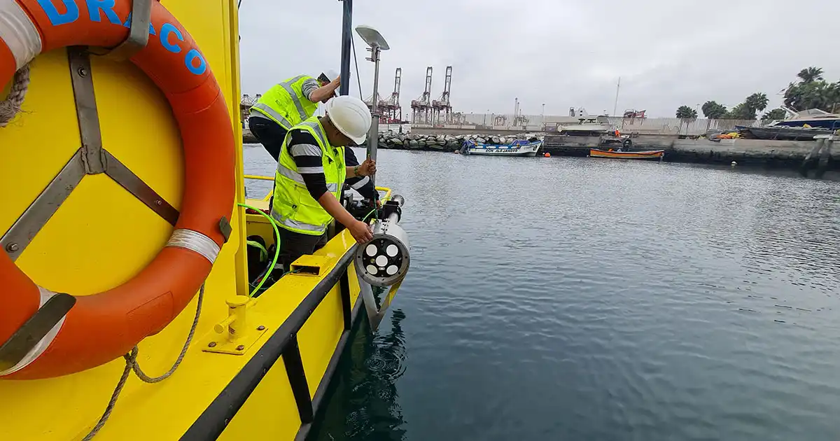
This is changing the role of Vessel-Mounted Acoustic Doppler Current Profiler (VM-ADCP) surveys. Once regarded as only a tool for current measurements, modern ADCPs like those used in Nortek’s VM systems are becoming multidisciplinary observation platforms for hydrology, physical oceanography, sediment dynamics, and environmental research.
More than Measuring Flow
Discharge measurements remain one of the most widely used applications of VM-ADCPs. Discharge information underpins operational decisions in rivers and estuaries, especially as extreme weather and pressure on freshwater resources increase the need for dependable data. Yet for many survey teams, discharge is only one part of a broader mission. River and coastal programs may also need to quantify sediment transport, identify erosion hotspots, investigate ecological conditions, or track nutrients and pollutants.
Modern ADCP technology offers not only the current velocity measurements required for river discharge calculations, but also advanced features that provide insight into suspended sediment and other ecological parameters.
A Multidisciplinary View
For example, multifrequency acoustic backscatter information from an ADCP provides insight into suspended material throughout the water column. With supporting measurements and calibration data, it can help detect and indirectly quantify sediments, biological material such as plankton, and floating or suspended plastics.
Vertical velocity measurements from ADCPs add another dimension. They can reveal processes often invisible in conventional current maps, including upwelling, internal waves, stratification, turbulent mixing and eddies. These processes influence sediment resuspension, nutrient exchange, oxygen transport, and primary productivity, placing discharge measurements within a richer environmental context.
Benefits of a Cohesive System
One of the main challenges for monitoring organizations is collecting, processing, validating, and interpreting data efficiently. Survey windows are often short, making reliable and efficient equipment and reporting capabilities of the utmost importance.
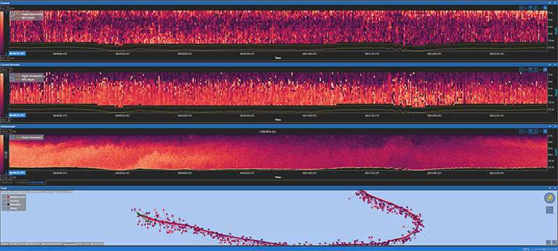
In an integrated VM-ADCP system, such as Nortek’s VM Coastal system, the ADCP, GNSS compass, AHRS, precision time protocol, and acquisition software operate as one coherent measurement system, resulting in higher-quality data and simpler processing and visualization. A coherent system can also use navigation and motion information to improve the ADCP data itself.
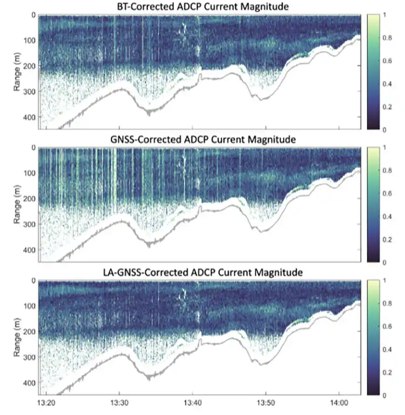
GNSS angular motion correction is a clear example. On a moving vessel, the GNSS antenna and ADCP are physically separated. Pitch, roll, and turns from the vessel introduce rotational motion at the GNSS antenna. Using angular velocities from the navigation system and AHRS with the known lever arm, Nortek’s VM Coastal can remove this component from GNSS velocity before it is used for ADCP vessel-motion correction.
The practical benefit is better current data. Removing this motion-related component helps reduce the vertical rippling that can otherwise appear in measured currents, making profiles cleaner and easier to interpret. Integration therefore not only makes the workflow faster; it improves the measurement itself.
Simplifying Discharge Measurements
Nortek’s VM Coastal software integrates discharge measurements directly into the acquisition workflow. Instead of relying on separate processing tools after the field, operators can calculate discharge in real time while monitoring built-in quality indicators. Automatic transect detection, edge extrapolation using GNSS positioning, and integrated quality checks simplify a demanding part of discharge surveying. At the same time, the GNSS-based vessel-motion reference helps prevent poor-quality data when bottom tracking becomes unreliable during high-discharge measurements. For US practitioners, data from the VM Coastal system can also be seamlessly moved to the QRev workflow for independent discharge review and quality assurance.
The result is a streamlined workflow that enables survey teams to focus less on software management and more on collecting high-quality environmental data. This discharge functionality complements the broader platform capabilities: the same survey can provide current profiles, backscatter-based particle insight, vertical velocities, and mixing information.
Looking Ahead
The development of VM-ADCPs reflects a broader trend in environmental science. Monitoring programs are moving from single-purpose measurements toward integrated observation strategies. The value of an ADCP survey will no longer be defined only by its discharge calculation or current profile, but by how much understanding can be gained from one field campaign.
For researchers and water resource managers alike, the future lies not in collecting more data for its own sake, but in collecting smarter, richer and more connected observations. Modern VM-ADCP platforms help turn routine surveys into opportunities to better understand rivers, estuaries and coastal oceans, transforming complex measurements into the understanding that gives users confidence in their decisions.
This feature appeared in environment coastal & offshore (eco) magazine’s 2026 issue IV. Read in the magazine here.