The endeavor was not purely academic. The industrial partners sought operational evidence that roving platforms can detect transient pollution signatures that buoy or fixed-station monitoring might miss—and that processed data can be delivered and visualized in a form commissioners can actually use.
So, why uncrewed and why roving? Traditional fixed stations are excellent for long-term trends at specific locations but struggle to resolve spatially diffuse or mobile sources— think agricultural run-off after heavy rain or intermittent sewage overflows that travel as plumes. The mobility of USVs expands the sampling footprint economically; they can follow tracks with high repeatability, sample across salinity gradients, and pinpoint hotspots correlated with wider open datasets.
A Unique Platform & Payload
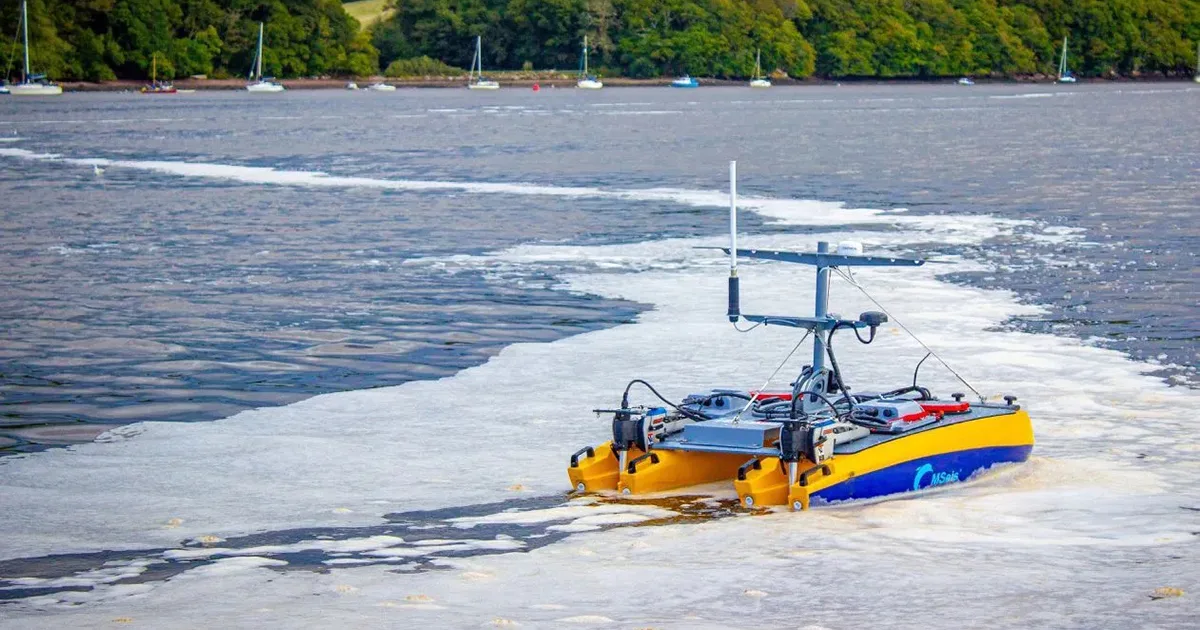
The project deployed three HydroSurv REAV-16 USVs—ultra-lightweight, trailer-portable catamarans specifically designed for data collection on inland and sheltered waters. Their form factor, onboard computing, and enterprise-grade connectivity make them wellsuited for repeated environmental surveys
Fluorescence did the detective work. Each craft carried Chelsea Technologies fluorometers comprising three UviLux sensors configured for tryptophan-like fluorescence (TLF), polycyclic aromatic hydrocarbons (PAH), and fluorescent dissolved organic matter (fDOM), plus a TriLux multiparameter probe for chlorophyll-a, turbidity, and phycoerythrin. Fluorescence-based optics are highly sensitive to subtle organic signals and, crucially, respond on short timescales.
TLF acts as a proxy for bacterial and microbial activity, while fDOM often flags fresher, decaying organic inputs and helps distinguish terrestrial from marine organic matter. Interpreted together with turbidity and chlorophyll channels, these sensors provide early warning of events likely to increase biological oxygen demand or alter local ecology.
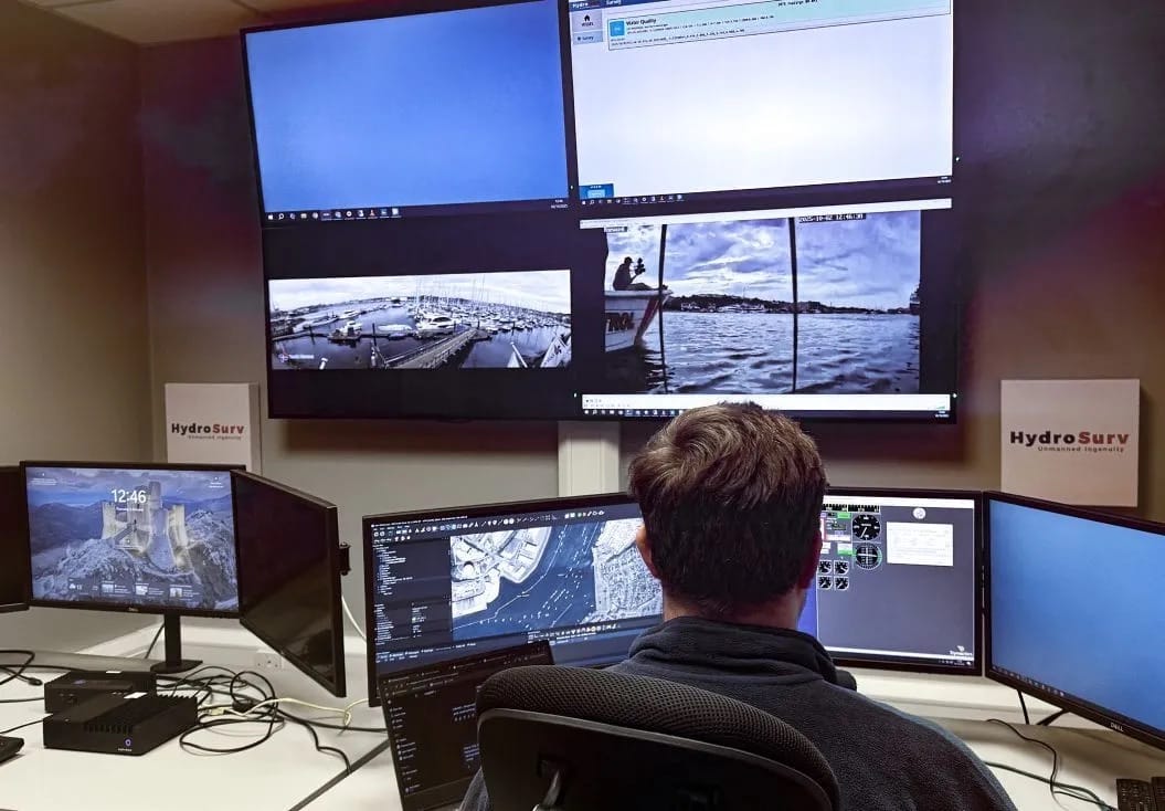
Collecting abundant data is only valuable if it’s accessible. One area of focus for the consortium was developing interpretive analytics for Chelsea’s sensor outputs—work that continues beyond the project. During the pilot, a simple data visualization dashboard was built and hosted on Hydro- Surv’s cloud-based data pipeline, EasySurv. The system provided geo-referenced data playbacks as layers on a digital chart, making comparative time-series analysis accessible to harbor authorities and other stakeholders. EasySurv’s intuitive interface allowed practitioners and decision-makers to interrogate data, compare weekly surveys, and overlay event flags with rainfall and tide records. Delivering that “last mile” of actionable, high-frequency environmental data for non-specialists was central to the project’s value proposition.
Lessons Learned
Operational lessons came quickly. Small USVs are zero-emission and highly portable, but endurance and recovery logistics shape what can realistically be achieved. Survey missions typically covered 10–12 km, allowing multiple worksites to be monitored in a single day. Travel between sites, particularly during the busy summer season in the southwest, was occasionally challenging. In parallel, HydroSurv demonstrated the potential for hands-off, fully remote surveys using a docking station capable of recharging the REAV-16 while running missions from the company’s Remote Operating Center (ROC) in Exeter. These capabilities significantly enhance the viability of resident, routine monitoring, potentially transforming survey productivity. The final pilot survey was conducted under fully remote operation from the Exeter ROC.
What did the pilot reveal? The project produced two key findings likely to resonate with environmental managers. First, episodic spikes in TLF and fDOM commonly followed heavy rainfall and coincided with combined-sewer overflow behavior. Experts from MSeis and Chelsea developed scripts to incorporate open data over much of the pilot, and analysis of the resulting year-long dataset is ongoing. Second, spatial mapping revealed highly localized events such as narrow plumes hugging particular channels or sheltered areas within harbors—which a fixed-position sensor network would likely under-sample.
Optimized Response Times
Beyond detection, the real value lies in response. Near-real-time mapping can be mobilized to managers far faster than lab results, a crucial capability when harmful pollution develops rapidly. The consortium is only beginning to explore the wider potential impacts of this data, working with interested stakeholders in the three communities involved in the study.
So, where next? From a technical perspective, further developments are planned to extend the survey specification, bringing additional datasets from complementary sensors both on the USV and via fixed networks. Immediate gains will also come from advancing the analytics and visualization into an indexed scheme of water quality—ongoing work led by Chelsea Technologies and their academic partners. The partners will present their findings at conferences in 2026.
The pilot has also become a blueprint for a more ambitious follow-on initiative. Both HydroSurv and Chelsea are engaged in discussions on the relevance of this approach within the context of Section 82 continuous monitoring of water quality upstream and downstream of sewerage assets in the UK. While Smart Ports, Clean Waters hasn’t solved every challenge in water-quality management, it has reframed one. Monitoring is no longer constrained to fixed points or slow data turnarounds. By combining advanced sensors, versatile USV platforms, and accessible cloud-based data delivery, the project offers a practical playbook for responsive, spatially aware environmental surveillance—one that could redefine how we understand and protect our coastal and estuarine ecosystems.
This feature appeared in environment coastal & offshore (eco) magazine’s 2025 winter edition Fisheries & Aquaculture, to read more access the magazine here.