To prepare for these extreme events, coastal managers and researchers need precise, localized data. They need to know exactly when and where a marine heatwave will strike, and just how warm the water will get.
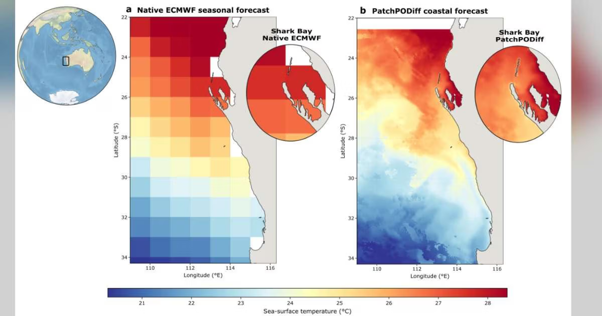
While global climate models simulate broad oceanic and atmospheric systems, their coarse resolution frequently fails to pinpoint localized coastal circulation and fine-scale sea surface temperature (SST) variations. In simple terms, they are just too blurry. This limitation is particularly evident during extreme phenomena like marine heatwaves.
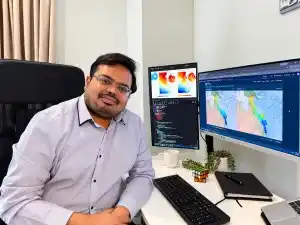
This exact challenge enticed UWA Research Fellow Dr. Onkar Jadhav to Western Australia.
A mathematician in Berlin before moving to Perth for this research, Onkar had long been interested in climate science. “I wanted to use my maths background for the betterment of society, and climate is going to be the next big thing,” said Onkar.
“People are worried about AI, but when you look at what is happening in Nepal and across the Pacific, climate science is what we really need to concentrate on. The high temperatures in our oceans is a big problem. Marine heatwaves are increasing a lot.”
With the effects of El Niño set to drive further warming in 2026 and 2027, the need for hyper-local forecasting has never been more urgent.
“Coastal managers need data fast, and they need it on a local scale. They need to know what temperature is going to hit a specific reef so they can make an informed decision as to how best protect it,” said Onkar. “The current coastal forecasting models offer a resolution of 50 kilometers or 25 kilometers, yet what we need is one or two kilometers.
“Existing models are also known to under-predict the ocean temperature, meaning a marine heatwave is missed entirely.”
Harnessing AI to Sharpen Ocean Forecasts
Onkar’s background in mathematics unlocked a new way to map these ocean extremes.
“Relying solely on satellite data and high-resolution ocean models was going to be super costly. I wanted to try machine learning—to see how we could use smart algorithms to ‘data mine’ heatwaves,” he said.
Onkar developed a two-stage AI system to sharply upgrade the spatial resolution of coastal sea surface temperature data. The initial model estimates overall SST patterns, while the second refines the results.
Getting the desired result wasn’t easy.
“For the first three months, it didn’t look like we could get what we wanted. When I was trying to predict these extreme temperatures, my model couldn’t do it due to a lack of training data,” explained Onkar. “That’s when I had the idea of adding synthetic data, which required a bit of luck. Combining limited data sets with synthetic options delivered the accuracy required.”
Onkar’s work incorporated marine heatwave data from the northwest of WA and the Great Barrier Reef in Queensland. He collaborated with national facilities like the Pawsey Supercomputing Research Centre in Kensington, using their high-powered processing units (GPUs) to train his AI models.
When tested against the 2011 West Australian marine heatwave, Onkar’s approach successfully identified localized temperature spikes and anomalies that global climate models overlooked. By systematically correcting high-temperature biases, the model proves it can detect extreme events even when data is scarce.
Ultimately, this framework provides an advanced early warning system, giving coastal managers a head start to protect marine life.
A Simple Tool for Predicting the Future
Driven by a passion to turn research into real-world action, Onkar is now building a user-friendly tool to put this data directly into the hands of marine managers.
“I’m building a geospatial analytical tool with machine learning functionality,” explains Onkar. “Coastal managers and researchers can input data into the software and easily generate animations, run analyses and generate reports, all without needing a background in maths or coding.”
WAMSI: Bridging the Gap Between Mathematics and Marine Science
A research project of this nature and scale required a unique cross-section of skills, from mathematics and coding to a deep understanding of oceanography.
To bridge this gap, Dr. Matt Rayson, Dr. Tim French, and Professor Nicole Jones from The University of Western Australia collaborated with Onkar, with the project facilitated by the Western Australian Marine Science Institution (WAMSI).
“Onkar has done a brilliant job of finding machine learning solutions in collaboration with oceanographers,” explains Professor Jones. “This project has unlocked ocean temperature forecasts at the spatial scales that marine managers need. These robust higher-resolution forecasts enable early decisions to be made, such as protecting a fishery that could be impacted by a marine heatwave.”
Onkar’s project, From Seasonal Ocean Forecasts to Actionable Coastal Information, was undertaken as part of a major collaborative Marine Heatwave study led by WAMSI and endorsed by the UN. The outcomes have been published in the Journal of Geophysical Research.