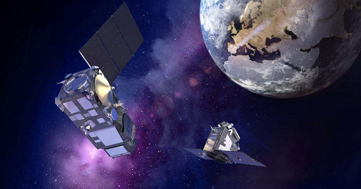
“I am delighted with the successful launch of these two satellites, which will provide unique data to scientists and policymakers to help understand climate change and preserve our ecosystems. They demonstrate Europe’s leadership in Earth Observation and are successful examples of collaboration within the European space sector in support of climate action,” said Hervé Derrey, CEO of Thales Alenia Space.
Sentinel-3C is an integral part of Copernicus, the world’s most advanced environmental monitoring program. This program is managed by the European Commission, funded by the EU and partially by the European Space Agency (ESA). It is jointly operated by ESA and EUMETSAT.
Sentinel-3C is the third satellite in the Copernicus Sentinel-3 mission, dedicated to monitoring the oceans and land surfaces. The Sentinel-3 satellites feature four state-of-the-art instruments which provide essential measurements on surface temperature, color, and height of the oceans. The mission also supplies data on land surfaces, including vegetation, soil temperature, inland water quality (lakes, rivers), and fire detection.
With a launch mass of approximately 1,140 kg, Sentinel-3C will operate in low Earth orbit at an altitude of 814 km, with an operational lifespan of 7.5 years. It will join the Sentinel-3B satellite in orbit and continue the vital mission of providing images essential to understanding ocean currents, climate phenomena, and the health of ecosystems.
FLEX (FLuorescence EXplorer) is a satellite in ESA’s series of innovative Earth Explorer missions. It will be the first to measure plant fluorescence from space with such a high degree of precision over vast territories. Data collected by FLEX and its instrument FLORIS, built by Leonardo, will further our understanding of how carbon moves between plants and the atmosphere, and of how photosynthesis affects the carbon and water cycles. With global warming and extreme climatic events—heatwaves, droughts, wildfires, winds, etc.—becoming ever more intense, the FLEX mission will help us to assess how climate change is impacting photosynthesis and, therefore, plant health and productivity. FLEX’s observations will help to optimize climate models, agriculture, and biodiversity monitoring.
Weighing approximately 400 kg, FLEX will operate in an 814-kilometer orbit, flying in tandem with one of the Sentinel-3 satellites. The mission’s operational lifespan in orbit is 3.5 years.
FLEX observations will be combined with those from Sentinel-3’s imaging spectrometer to correct for atmospheric bias and precisely quantify the level of fluorescence on the ground. Sentinel-3’s optical and thermal sensors will provide FLEX with complementary data on the plant’s environment. Data from both satellites will improve measurement accuracy, increase the temporal coverage of vegetation, and allow for a better interpretation of fluorescence within its environment.
The Sentinel-3 mission illustrates the solid partnership between ESA, the European Commission, the European Organization for the Exploitation of Meteorological Satellites (EUMETSAT), industry, service providers, and data users.
Thales Alenia Space in France, prime contractor for the satellites, is also responsible for developing two key instruments—the imaging spectrometer (OLCI) and the radar altimeter (SRAL)—as well as the platform. Thales Alenia Space entities in Spain, Belgium, and Italy are also involved. A consortium of more than 100 European companies contributed to the design and construction of the satellites, including Leonardo for the imaging radiometer (SLSTR) and Airbus Defence & Space for the microwave radiometer (MWR).
The FLEX mission illustrates the collaboration between ESA and the European space industry. Thales Alenia Space in France, prime contractor for the satellite, is also in charge of developing the platform, which also involves its Harwell and Belfast sites (United Kingdom) for the propulsion module and platform integration, Charleroi (Belgium) for on-board power management, Gorgonzola and L’Aquila (Italy) for the central computer’s processor board, and Madrid (Spain) for S- and X-band communications. A consortium of almost 40 European companies contributed to the construction of this satellite, including Leonardo, responsible for the high-resolution FLORIS imaging spectrometer that will map plant fluorescence, and Beyond Gravity, notably in charge of supplying the structures and thermal control for the platform and associated satellite engineering.