Additionally, NOAA is now producing a new high-resolution Experimental Monthly High Tide Flooding Outlook, demonstrating the potential of CORA to advance NOAA’s flood prediction capabilities. The new CORA dataset provides a more complete picture of how coastal water levels and flood frequencies have changed over time. The expanded dataset has the potential to help decision makers plan for and mitigate coastal community flooding impacts.
Closing Historical Data Gaps
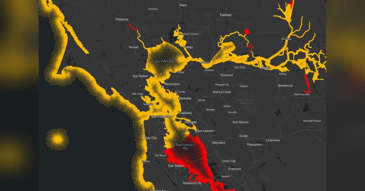
CORA’s new model-derived dataset leverages more than 45 years (1979–2025) of historical water level information from NOAA tide gauges to produce simulated historical water levels and waves every 500 meters, or roughly every quarter mile, along the coast. Historical water level data was previously only available at specific locations where NOAA had installed tide gauges. While NOAA’s National Water Level Observation Network provides highly accurate data for coastal safety and preparedness, these long-term stations are physically separated by distances that can span hundreds of miles. The new CORA-derived dataset builds upon the existing Gulf, Atlantic, and Caribbean coast datasets released in January 2025.
Experimental Outlook Delivers Flood Risk Insights to More Communities
For the new, high-resolution Experimental Monthly High Tide Flooding Outlook, this outlook for the US Atlantic and Gulf coasts uses data from NOAA tide gauges supplemented by CORA to extend NOAA’s existing monthly high tide flooding predictions to locations every 500 meters along the coast. Previously, data was only available at 66 NOAA tide gauge locations. This experimental product demonstrates how CORA data can be used to provide high tide flooding outlooks in additional locations along the coast, providing more communities with valuable information to help minimize potential flooding impacts.
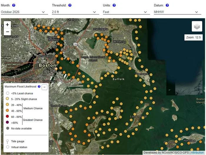
The experimental high-resolution flooding outlook was created in direct response to user requests for outlook information between NOAA tide gauges. During this experimental phase, user feedback will continue to help NOAA refine the product so it best meets users’ flood planning needs.
The experimental high-resolution outlook provides valuable situational awareness of the likelihood of high tide flooding each day in the calendar year, up to a year in advance. Communities can use the experimental high-resolution outlook to identify windows of time when high tide flooding might occur in the coming weeks to months so they can prepare for potential impacts with substantial lead time. Real-time weather conditions may still cause flooding outside of dates identified in this product. This information can help coastal planners, floodplain managers, and transportation officials better coordinate staffing, resources and hazard mitigation, and response activities.