This work is spearheaded by the Mesophotic and Deep Benthic Communities (MDBC) portfolio, a set of restoration projects in the deep Gulf following the Deepwater Horizon oil spill. NOAA and the Department of the Interior are leading four complementary MDBC restoration projects to restore and improve understanding of these habitats to inform management and ensure resiliency. One of the projects—Mapping, Ground-Truthing, and Predictive Habitat Modeling (MGM)—is tasked with mapping where coral habitats occur across the Gulf and building predictive models to guide future restoration.
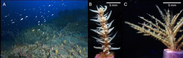
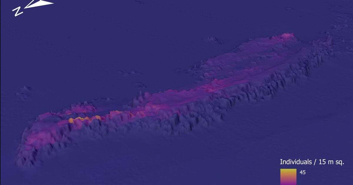
The MGM team’s work produces progressively more detailed information in phases. First, ship-based mapping shows seafloor features that might be of interest. Then, autonomous underwater vehicles (AUVs) can map these areas down to centimeter resolution, capturing fine-scale details of the seabed. ROVs can also collect videos in the same sites, allowing experts to ground-truth mapping data visually. This helps us see where the corals are and where they aren’t, which is important information for the models. These data each provide a piece of the seafloor puzzle, all of which is fed into the predictive habitat models.
The models are generalized additive models (GAMs), which apply a statistical approach that fits flexible curves between environmental variables that characterize the seafloor and coral counts. These are often used when the relationship between the variables is not very straightforward, and they’re ideal for integrating the many environmental variables that contribute to the model. The models use a wide range of predictor data, including bathymetric data like depth, slope, and seafloor roughness, geographic variables like distance to depth contours, and backscatter data indicative of seafloor hardness. The team tested each predictor at multiple spatial scales (8, 24, and 216 meters) to capture patterns at different levels of detail.
Although global models for corals already exist, they are at scales of tens to hundreds of kilometers. The MGM team is working at a scale of just tens of meters, allowing us to see features in deep-sea habitats that would be lost in coarser maps and are more relevant to restoration activities planned for sites across the Gulf. The team is creating two classes of models, one at tens of meters and one at hundreds of meters, to see where corals occur and the densities of specific coral species. Predicting the densities of corals, instead of just whether or not they are present in an area, is a major advancement over previous models. Based on the priorities of MDBC and available data, the team chose to model 13 taxa including black corals, soft corals, and stony corals. They focused their initial efforts on a priority area spanning the Mississippi, Alabama, and West Florida continental shelf. Later, they will focus on two additional priority areas: the deep salt domes on the Mississippi-Alabama continental slope and a large swath across the Texas-Louisiana continental shelf and slope.
These models synthesize years of mapping data and ROV ground-truthing, and take about a year to develop once all of the data is ready. Once the models are built, they can be validated, or tested, using additional field data. As MDBC restoration fieldwork continues, the team will continue to refine these models so they are as useful as possible for predicting suitable habitat for coral outplanting.
These models contribute substantially to restoration efforts in the Gulf, and they also serve as a blueprint for how to combine diverse predictor variables into fine-scale models that can be applied to deep-sea coral communities in other parts of the world.