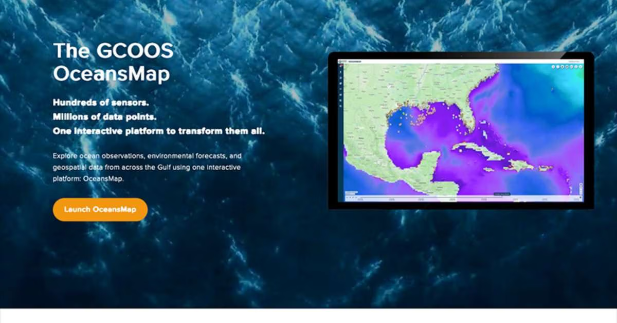
Developed in collaboration with Tetra Tech, OceansMap provides users with multiple types of data on a single map viewer, allowing them to examine how conditions change over time, compare observations with forecasts, and create customized views tailored to their interests or needs.
“GCOOS has spent years building the infrastructure to collect, organize, and share environmental information from across the Gulf,” said Dr. Jorge Brenner, GCOOS Executive Director. “OceansMap represents an important next step moving beyond making more data available: it’s a new way to help people use data we’re already hosting to answer questions, understand what’s happening in the Gulf, and make more informed decisions.”
From Ocean Data to Real-World Action
The Gulf is monitored by an extensive network of sensors located on buoys, moorings, autonomous surface and underwater vehicles, and even satellites. These tools generate information about water temperatures, currents, winds, wave height, and other oceanic and atmospheric conditions. Forecast models add another dimension, helping users anticipate how conditions might change over the coming hours or days.
While much of this information is already publicly available, finding, comparing, and interpreting it can require specialized knowledge and navigating multiple websites.
OceansMap, launched earlier this month during the GCOOS Fall Members’ Meeting, brings these different sources together in a common, interactive environment, making it easier to visualize and understand relationships among changing conditions.
For example, during hurricane season, emergency managers and researchers now have the ability to overlay forecast ocean currents with active hurricane tracks to examine how ocean conditions could change along a storm’s projected path. By comparing multiple data layers and moving through forecast periods, users can explore the interaction between real-time or near-real-time ocean conditions and approaching storms.
And, unlike other proprietary platforms, OceansMap is free and publicly available to all users as part of GCOOS’s core mission of sharing reliable, timely, and accurate data across all ocean sectors and communities.
Making Complex Information Easier to Explore
Among OceansMap’s features are interactive maps, customizable data layers, time-series graphs, and tools for comparing observations with forecast models. Users can examine historical and forecast conditions, save locations of interest, generate visualizations, and download selected information.
The OceansMap Share tool also allows users to create customized map views and generate a unique link that can be shared with colleagues or others, who can then see the same information and settings simply by loading the link. This capability supports collaboration among scientists, resource managers, and operational teams working in different locations.
“There’s an enormous amount of valuable ocean information available, but bringing it together in a way that people can readily explore and understand is a different challenge,” said Kelly Knee, Director of Tetra Tech’s Ocean Science team. “OceansMap gives users the ability to move beyond looking at individual datasets and start seeing how different conditions relate to one another. That’s where data becomes much more actionable.”
Built on a Strong Foundation of Ocean Observations
The development of the GCOOS OceansMap builds on years of federal and regional investment in ocean observing and data-management systems. By drawing on existing GCOOS data services, forecast models, and publicly available geographic information, the development team was able to stand up the new operational platform in a matter of months.
“This new powerful tool is making ocean data more accessible to more people,” Brenner said. “And, as we move forward, we can add new insights to the map geared toward different stakeholder groups based on their interests and even their geographic locations.
“OceansMap is a tool we expect to continue building with input from the people who use it. As we learn more about what different users need, we can make it even more valuable—whether they’re studying the Gulf, managing its resources, working on the water, or simply trying to better understand the environment around them.”