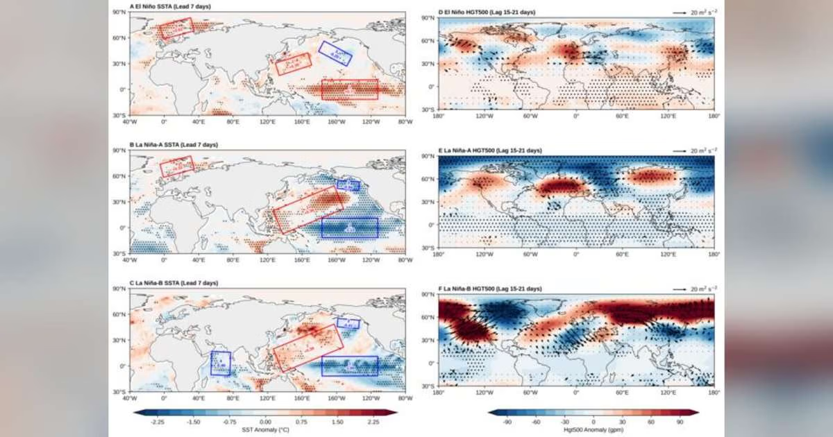
Using ECMWF hindcast data for the winters of 1997–2021, the team identified 14 such high-skill windows, comprising 56 forecast cases. The pre-forecast atmospheric circulation could not distinguish them, leaving a false alarm ratio of about 19%. The answer lies in the ocean. Regardless of the ENSO phase, every window is preceded by the same “warm-west/cold-east” SST dipole in the mid-latitude North Pacific.
The dipole alone, however, is not enough: a high-skill window occurs only when it is joined by a matching SST configuration in the other key regions, which also decides which of two dynamical pathways is taken. Warm anomalies over the Barents-Kara Seas, an indicator of sea ice loss, favor the Rossby wave train excited by the dipole over the North Pacific to maintain and then sustain the Ural blocking high. Cold anomalies over the Indian Ocean instead confine the wave energy to the North Pacific-Polar sector and force a meridional dipole that steers polar air southward. Forecasts selected by requiring the SST anomalies in all the key regions to meet their thresholds at the same time reach hit rates of 100% under La Niña-A, 95% under La Niña-B, and 90% under El Niño conditions.
Forecast skill windows are thus not randomly distributed but physically traceable. Once the SST configuration emerges in the key regions, forecasters can judge in advance that the coming 2–3 weeks are likely to be a high-skill period, which is of practical value for energy dispatch and agricultural disaster prevention.
Liu X, Su J, Wang H. 2026. Identifying SST precursors for forecast skill windows of East Asian winter cold surges. Science China Earth Sciences, 69(8): 2879–2888, https://doi.org/10.1007/s11430-026-2013-2