The highlighted regions are the newly added HAB monitoring products on the NCCOS HAB Monitoring webpage.
The new Coastal Northeast US satellite imagery supports bloom tracking in the Gulf of Maine and coastal waters off New York and New Jersey. These products provide satellite-based information to help partners better understand potential bloom conditions across a broad coastal region.
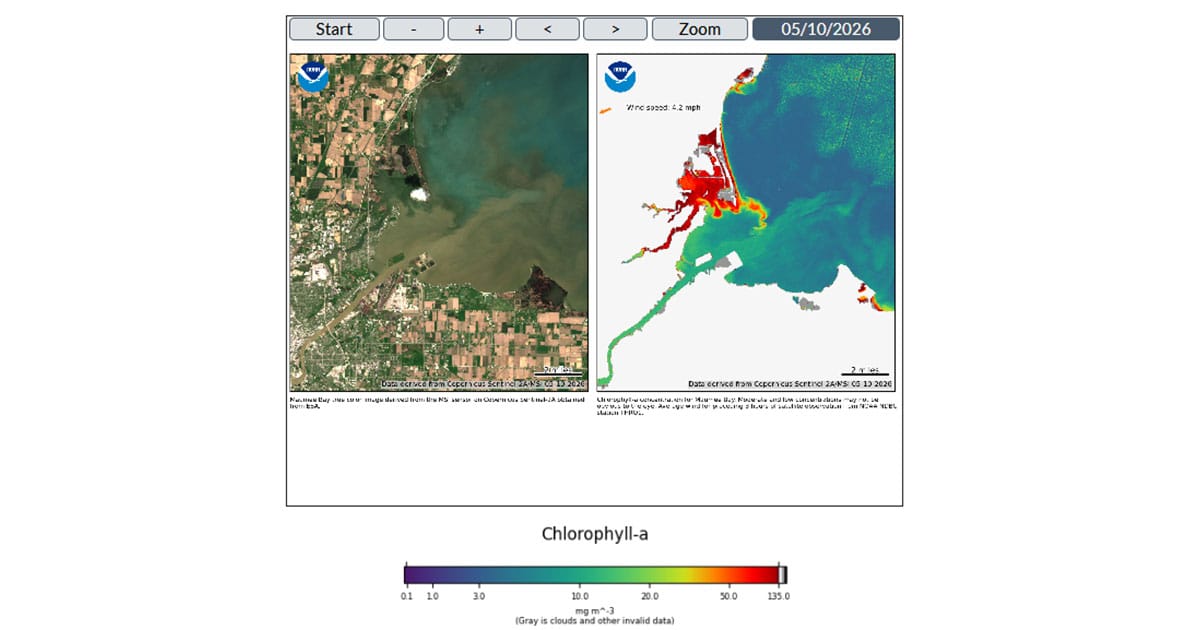
NCCOS is also adding a separate demonstration high-resolution Great Lakes satellite imagery to include Maumee Bay, OH, Apostle Islands, WI, and Saint Louis River, MN. These products use Sentinel-2 MultiSpectral Instrument imagery, which provides higher spatial resolution (20 m) than existing Sentinel-3 Ocean and Land Color Instrument products (300 m). The higher-resolution imagery can support monitoring in smaller or more complex water bodies where finer-scale satellite observations may be useful.

Satellite images of Maumee Bay, OH on May 10, 2026, one of the new locations highlighted by NCCOS for HAB monitoring.
These new regions strengthen NCCOS’s ability to deliver timely, science-based tools for state, local, and regional partners working to protect public health, coastal economies, and aquatic ecosystems from the impacts of HABs.
The new monitoring regions are available through the NCCOS HAB Monitoring website.
This work is authorized under the Harmful Algal Bloom and Hypoxia Research and Control Act (33 U.S.C. §§ 4001 et seq.).