Scott Creek is a high-energy wave environment where the lagoon, river, dune, and marsh systems are currently constrained by the existing Highway 1 configuration. At this site, Highway 1 has had emergency stabilization actions applied, but a deteriorating bridge and need for a more resilient roadway resulted in Caltrans and California Coastal Commission collaborations to address the unique needs of the site. Ideally, a proactive adaptation project will move forward before additional emergency maintenance costs deplete the state budget, sidelining projects with better return on investment.
The workshop brought together experts, including over 70 Caltrans employees from Districts 4 and 5, along with California Coastal Commission employees, to explore the history of the site, its vulnerabilities, inherent limitations of traditional coastal armoring, and natural infrastructure alternatives. The proposed adaptation for Scott Creek involves elevated bridge and roadway reconfigurations that accommodate lagoon restoration and allow natural processes to return, avoiding the “coastal squeeze” caused by rising seas. By aligning infrastructure with the natural landscape, the project aims to reduce flooding hazards in the watershed while maintaining regional transportation needs.
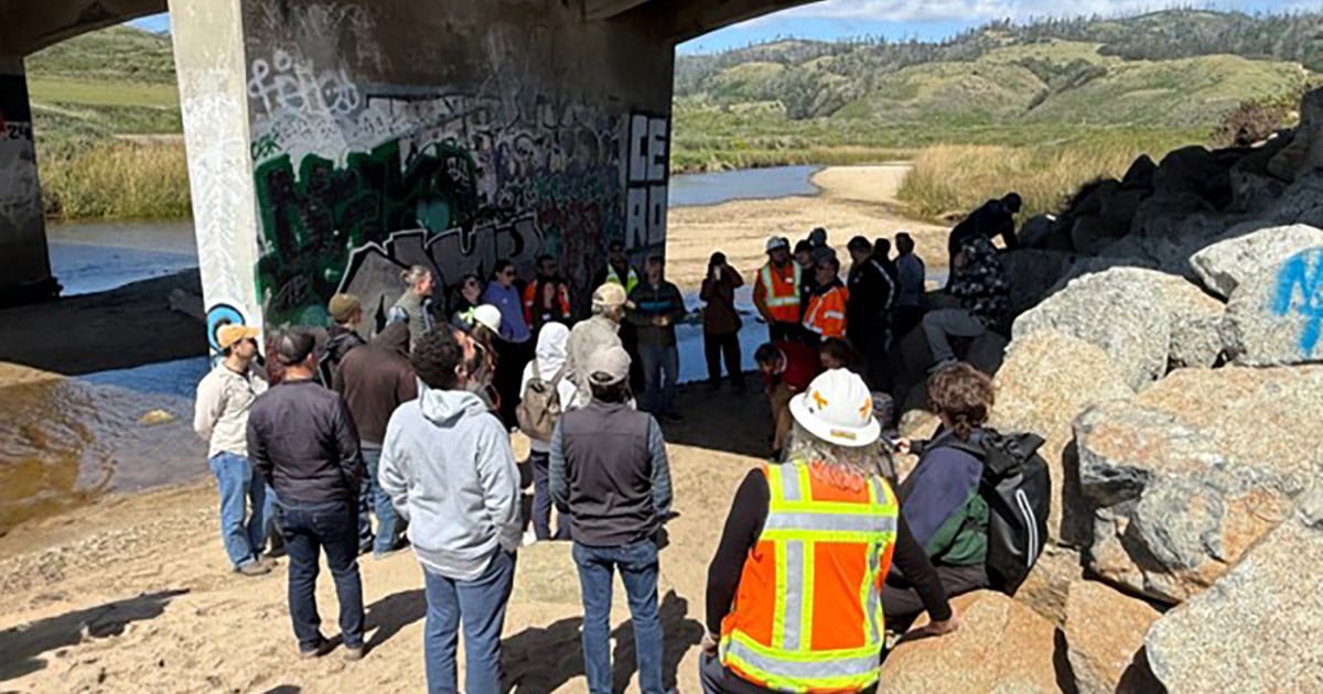
Following the workshop, attendees proceeded to a site visit to explore the needs and challenges in more detail. This meeting showcased what has been a collaboration for more than 10 years and marks a critical step in taking a holistic view of a transportation site rather than traditional infrastructure planning processes that often focus on one aspect of transportation, to ensure this critical infrastructure fulfills its service life (75–100 years) while preserving public access to the beach and protecting sensitive species.