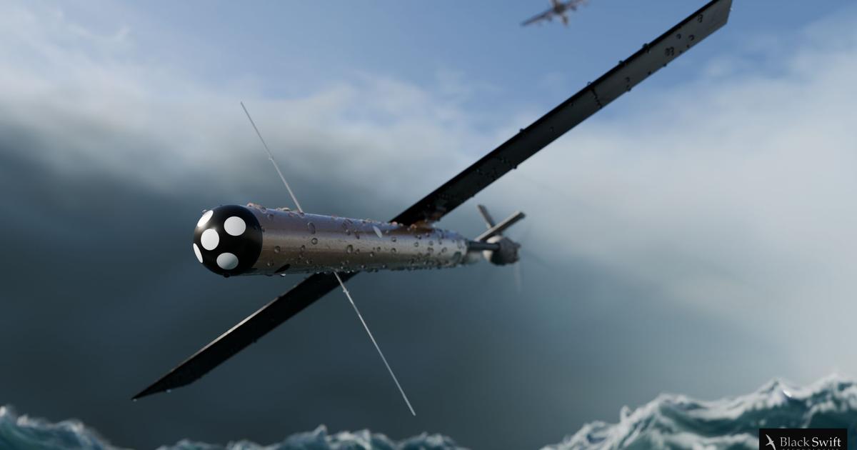
The novel feat, coined Mobile Ocean Towers, enables scientists to fly two Black Swift S0 sUAS simultaneously at different altitudes within a storm, in addition to the crewed Hurricane Hunter aircraft. By collecting data at multiple levels of the atmosphere, Mobile Ocean Towers provide a three-dimensional view of how storm dynamics change from the ocean surface to higher altitudes, offering insights into storm structure.
In the Lala deployments, two pairs of S0s successfully operated in two distinct modes: Lagrangian and Eulerian sampling. In a traditional Lagrangian approach, the vertically stacked S0s are piloted along the direction of the wind flow, collecting data in tandem around the eyewall. Alternatively, using the Eulerian technique, the vertically stacked S0s turn directly into the wind to remain virtually stationary in a fixed position—similar to a virtual anchor used by boats. This Eulerian capability provides a groundbreaking method for scientists to lock onto specific storm features and gather far more detailed data from targeted regions. In Lala, real-time communications between S0 operators onboard the P-3 and National Hurricane Center forecasters in Miami allowed forecasters to request the S0 to target distinct areas of the storm utilizing both Lagrangian and Eulerian methods.
The close proximity to the deployment aircraft also facilitates high data transmission between the S0 and the P-3. It also allows for strategic flyovers from NOAA’s P-3 aircraft. These interactions can increase data density and allow for enhanced data validation with other expendables and remote sensors on the crewed aircraft.
“It’s an extremely exciting time in emerging hurricane technologies,” said Joseph Cione, Lead Meteorologist for Emerging Technologies at NOAA’s Atlantic Oceanographic and Meteorological Laboratory (AOML). “These new capabilities are allowing us to collect unprecedented data in new ways and new areas.”
Deployments into Hurricane Lala were historic for yet another reason—a 136-minute record-breaking S0 flight duration into a storm. A mini radar that helps control elevation during low-altitude flights also made possible sustained flying at just 10 meters above sea level, revealing wave characteristics and critical data on ocean-atmosphere interactions.
These new feats are the culmination of meticulous planning, coordination, and test flights with partners at Black Swift Technologies, NOAA’s Uncrewed Aircraft Systems Division, NOAA’s Aircraft Operations Center, and academic partners spanning multiple years. In March and April of 2026, the Emerging Technologies team, a part of AOML’s Hurricane Research Division, led test flights over the Atlantic to evaluate the S0s’ performance using both Lagrangian and Eulerian techniques. During the simultaneous dual-altitude flight, the two sUAS flew through areas with significant precipitation and maintained synchronous flight paths at different altitudes for over two hours. The high-density observation data collected by each sUAS was successfully transmitted to the National Hurricane Center’s forecast visualization tool, a crucial step in S0 data being integrated into hurricane forecasts and prediction models.
Deployed from NOAA’s P-3 Hurricane Hunter aircraft, S0s are equipped with a suite of sensors to maximize the amount of data transmitted during flight, including air pressure, temperature, relative humidity, wind speed, wind direction, turbulence, and, when flying in the marine boundary layer, the S0s also measure sea surface temperature and wave height.
sUAS have proven to be reliable platforms for collecting critical atmospheric data in difficult-to-reach and hazardous regions of storms that are inaccessible to, or cannot be safely sampled by, crewed aircraft. Mobile Ocean Towers flight capabilities represent a significant leap forward in how scientists can observe and understand hurricanes. By giving researchers the ability to sample multiple altitudes simultaneously and hold position over targeted areas of a storm, S0 sUAS can capture a more detailed, persistent picture of storm structure. As these capabilities continue to advance, they have the potential to expand the reach of hurricane observations, fill critical gaps in existing data, and provide scientists and forecasters with new information to improve our understanding and prediction of tropical cyclones.