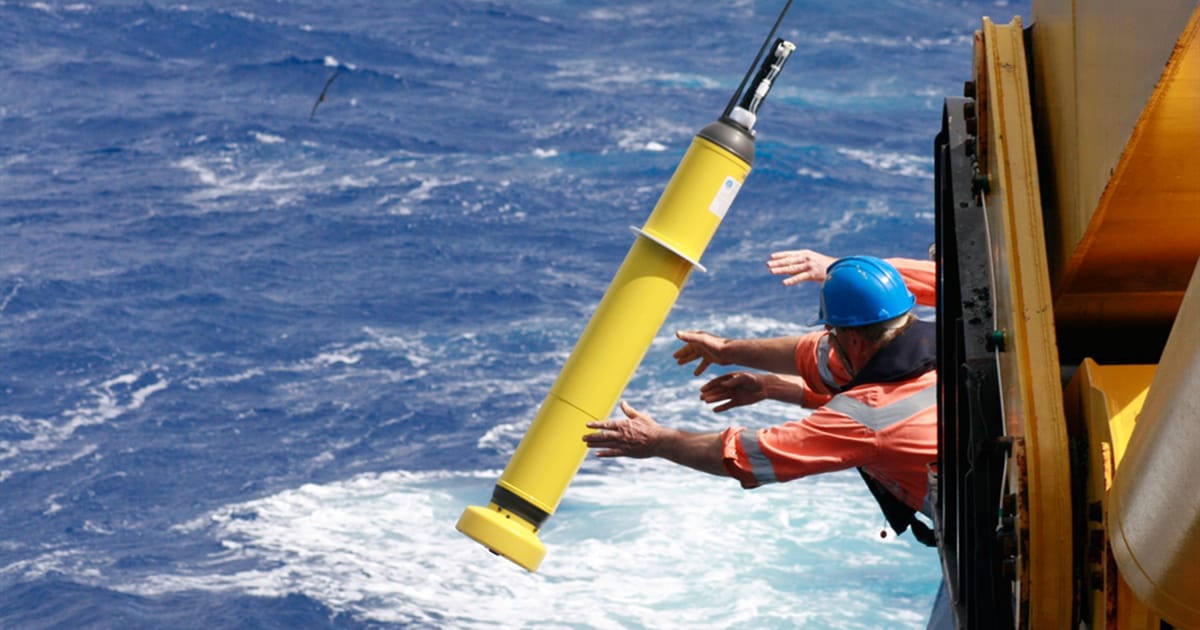
Going Where Humans Can’t
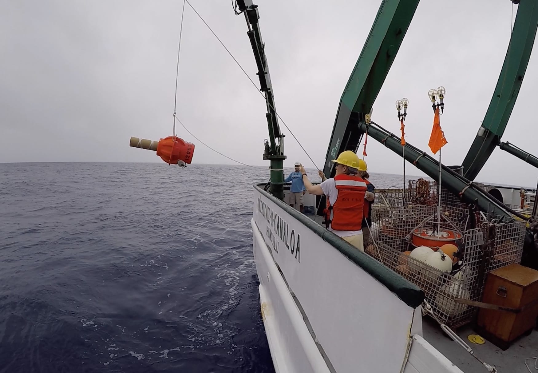
Once deployed into the ocean, Argo floats dive between one and nearly four miles deep to collect data and drift with currents. Every 10 days, the floats surface to transmit a “data profile”—a snapshot of ocean information captured by the floats during that period. Those data are transmitted by satellite to global data centers, where the information collected by the floats is publicly available for free. On average, floats last five years on battery life, collecting ocean information from hard-to-reach parts of the globe and weather events that are too dangerous for humans to venture to, like hurricanes.

The Argo Program is named after the Greek mythical ship Argo, which was captained by Jason, leader of the Argonauts. Argo was named to emphasize the complementary relationship between Jason satellite products and Argo floats. These floats have collected global ocean temperature and salinity data since the program’s inception in 1999. In the course of 25 years, that equates to more than three million data profiles and four times the amount of ocean information than collected from all other ocean observing tools—like ships and moored buoys—combined.
The fleet is remarkably efficient, notes Gregory C. Johnson, an oceanographer from NOAA’s Pacific Marine Environmental Laboratory (PMEL), who has worked on Argo since 1999. Johnson calls Argo the “crown jewel” of open ocean observing systems, providing measurements year-round and in near real time. Remarkably, Johnson notes, “the entire Argo array consumes about 120 watts—that is about 60% of the power used by a single Sony PlayStation 5 when gaming.”
“Argo is for everyone. These data are freely available… don’t hesitate to be an explorer,” said Andrea Fassbender, NOAA Pacific Marine Environmental Laboratory (PMEL) scientist.
25 Years of Innovations in Observations
The original Argo array consisted of core floats measuring temperature and salinity in the upper 1.2 miles (2,000 meters) of the ocean. In recent years, scientists and engineers have developed new capabilities and new types of floats that, together, make up a new full-depth and multidisciplinary design called OneArgo, an ambitious expansion of Argo’s first design. In addition to Core floats, OneArgo includes biogeochemical and deep Argo floats.
Biogeochemical Argo floats include more sensors to measure ocean variables that are critical for understanding and addressing environmental issues, like low oxygen levels and ocean acidification.
”When biogeochemical Argo reaches global coverage, we will, for the first time, be able to monitor on a global scale in real time the pH of the ocean,” says Emily Osborne, a scientist with NOAA’s Atlantic Oceanographic and Meteorological Laboratory. Monitoring ocean pH is particularly important for tracking the health of many marine organisms.
Deep Argo floats extend the robots’ depth range to 3.7 miles (6,000 meters) below the ocean surface. The deep ocean is another place where the data scarcity is “outrageous,” says Susan Wijffels, a senior scientist with the Woods Hole Oceanographic Institution, who has worked with Argo since 1999. Deep Argo’s first mission will map the deep ocean in detail, allowing scientists to better understand what controls deep ocean flows and then track changes there.
To boost the expansion and impact of these sentinels of the sea, the Argo Program received $2.7 million in funding in April 2024 to support the implementation of OneArgo. This funding will enhance observing capabilities in two key regions that are ecologically and economically important to the US: the Gulf of Mexico and the California Current ecosystem.
“There will be a huge amount of science discoveries that come out of the OneArgo array when implemented,” says Wijffels.
In October 2024, GOMO’s Arctic Research Program received $1.2 million for the expansion and enhancement of the Argo float array into the Arctic, where data collection has been traditionally sparse.
“Improved understanding of the ocean means improved understanding of how best to harness it as a source of food, power, recreation, tourism, and climate mitigation in ways that sustain these services and the ecosystems that many Americans value,” says Andrea Fassbender, a scientist at PMEL who began working with Argo data as a graduate student in 2012.
“Argo is for everyone. These data are freely available, as are many open-access tools for looking at the data,” says Fassbender. “Don’t hesitate to be an explorer.”
Fun Facts About Argo
Argo data is used in nearly 600 NOAA products, touching all of the goals in NOAA’s strategic plan (except for those related to space weather). The data are also used in more than 500 scientific publications annually—that means more than one scientific paper is published using Argo data every day!
Twenty-six countries participate in Argo’s international program, and NOAA is a leader among them. Through the Global Ocean Monitoring and Observing Program (GOMO), NOAA funds half of the international Argo Program.
The Argo Program delivered 3 million temperature and salinity profiles in 25 years, which is four times the amount of ocean information collected from all other ocean observing tools combined.
Floating into the Future
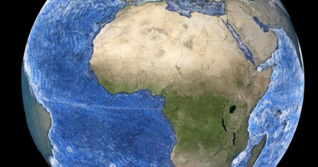
As we look back on a quarter century of Argo’s achievements, we also look ahead to the program’s potential to revolutionize our understanding of the global ocean—from the poles to the tropics, under ice and to new depths—at a time when the ocean is changing more rapidly than ever before.
With technological advancements and support for these ocean observations, the Argo Program will add new dimensions to ocean and climate research that improve seasonal to daily forecasts, support disaster preparedness, and contribute to climate resilience in communities throughout the nation.